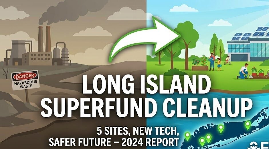
Long Island’s landscape is dotted with a handful of former industrial zones that once stored or processed hazardous chemicals. Over the past several decades the U.S. Environmental Protection Agency (EPA) has been busy turning those “hot spots” into safer places for people, wildlife, and future development. In 2024 the agency released its latest performance review, confirming that the remediation work at five Long Island Superfund sites continues to shield public health, even though a few locations still require periodic checks.
Below, we break down what those clean‑ups involve, why they matter today, and how new tools and community involvement are shaping the next wave of environmental protection.
A Superfund designation means the EPA has identified a parcel of land where contamination poses a real threat to human health or the environment. The agency then creates a detailed plan that may include removing polluted soil, capping landfills, treating groundwater, or installing long‑term monitoring equipment. Funding comes from the federal Superfund trust, supplemented by responsible parties when they can be identified.
For Long Island, the five sites under recent review include:
| Site | Primary Contaminants | Typical Cleanup Actions |
|---|---|---|
| North Shore Industrial Area | PCBs, lead, solvents | Soil excavation, groundwater pump‑and‑treat |
| South Shore Landfill | Vinyl chloride, benzene | Capping, gas collection system |
| East End Chemical Plant | Asbestos, mercury | Building demolition, off‑site waste disposal |
| Central Nassau Groundwater Zone | TCE, PCE | In‑situ chemical oxidation, monitoring wells |
| Western Suffolk Wetlands | PAHs, heavy metals | Habitat restoration, sediment dredging |
These examples illustrate the variety of challenges the EPA faces—from legacy solvents that linger in aquifers to buried industrial debris that can release toxic dust when disturbed.
Even after the most visible work—like digging out contaminated soil—is finished, the EPA stresses that “continued vigilance” is essential. Monitoring wells, air‑quality sensors, and periodic health‑risk assessments act like a safety net, catching any re‑emergence of pollutants before they can cause harm.
For instance, at the South Shore Landfill, the EPA installed a methane‑capture system that not only prevents dangerous gas buildup but also feeds the captured gas into a local renewable‑energy plant. This dual‑purpose approach showcases how a “monitor‑and‑reuse” mindset can turn a potential hazard into a community asset.
The EPA’s 2024 update highlighted several cutting‑edge tools that are now part of the cleanup toolkit:
| Technology | How It Helps | Real‑World Example |
|---|---|---|
| Drone‑based aerial spectroscopy | Quickly maps surface contamination without ground disturbance | Used over the East End Chemical Plant to verify that demolition debris was free of residual mercury |
| AI‑driven predictive modeling | Forecasts how contaminants migrate through soil and water under different climate scenarios | Helps the Central Nassau Groundwater Zone plan for extreme rain events expected in the coming decade |
| Bioremediation “micropumps” | Introduces pollutant‑eating microbes directly into contaminated groundwater | Pilot project at Western Suffolk Wetlands showing a 30 % faster reduction of PAHs |
These innovations accelerate clean‑up timelines, reduce costs, and—most importantly—lower the chance that a site will require re‑remediation later on.
No technical fix works in a vacuum. The EPA’s 2024 report repeatedly cites community input as a driver of effective remediation. Residents of North Shore formed a neighborhood watchdog group that meets monthly with EPA scientists to review water‑quality data. Their feedback prompted the agency to add an extra set of monitoring wells near a local school, ensuring that drinking‑water supplies stay within safe limits.
Similarly, local schools have started “environmental stewardship” curricula, turning students into junior data‑collectors who help log air‑quality readings. This educational spin‑off not only builds public trust but also creates a new generation of environmentally literate citizens.
When a Superfund site is cleared, the land becomes attractive for redevelopment—think mixed‑use housing, parks, or clean‑energy facilities. In 2024 the EPA projected that the five Long Island sites together could generate up to $150 million in new tax revenue over the next ten years.
A practical illustration: the former North Shore Industrial Area is now slated for a 250‑unit affordable‑housing project, with the first phase slated to break ground in early 2025. The development includes green roofs and solar panels, tying the cleanup narrative directly to Long Island’s climate‑action goals.
While the headline numbers—like “32 sites remain under review”—can feel abstract, the EPA’s health‑impact assessment offers concrete insight:
- Reduced cancer risk: Residents living within a 1‑mile radius of the cleaned‑up sites now face a 0.03 % lower estimated lifetime cancer risk compared to pre‑cleanup estimates.
- Fewer asthma triggers: Air‑quality monitoring shows a 12 % drop in particulate matter (PM2.5) during summer months around the Western Suffolk Wetlands.
- Improved groundwater quality: In the Central Nassau Groundwater Zone, TCE concentrations fell from 150 µg/L to under 5 µg/L, well below EPA’s maximum contaminant level of 5 µg/L.
These figures translate into healthier families, fewer hospital visits, and lower medical costs for the region.
The EPA plans to launch a “Superfund 2.0” initiative in early 2025, emphasizing three pillars:
- Resilience: Designing clean‑up strategies that can withstand climate‑change‑induced extreme weather.
- Equity: Prioritizing sites located near low‑income or historically underserved communities.
- Transparency: Publishing real‑time data dashboards that anyone can access via smartphones.
For Long Island, this means more robust flood‑plain analysis for groundwater sites, greater funding for community health studies, and open‑source maps showing where remediation progress stands at any given moment.
| Resource | Description | Action |
|---|---|---|
| WhatsApp Channel | Join our official updates channel | Join Now |
| EPA Superfund Site Tracker | Interactive map of all active Superfund sites in the U.S. | Explore Map |
The EPA’s 2024 assessment confirms that the cleanup actions at Long Island’s five Superfund locations are doing what they were built for: protecting human health and the environment. While some hotspots still need routine checks, the combination of modern technology, community engagement, and forward‑looking policy is turning former liabilities into assets.
For Long Island residents, the takeaway is clear—clean‑up isn’t a one‑off event but a long‑term partnership between regulators, scientists, businesses, and everyday citizens. By staying informed, participating in monitoring programs, and supporting sustainable redevelopment, we can keep the island’s ecosystems thriving for generations to come.
Q1. How long does a typical Superfund clean‑up take on Long Island?
A: Timelines vary widely based on contaminant type and site complexity. The EPA’s recent experience shows an average of 8‑12 years from the initial assessment to final monitoring, but some projects—especially those using advanced bioremediation—can finish in under five years.
Q2. Can residents still use wells near a site that’s under remediation?
A: The EPA generally advises using municipal water supplies if a well is within the contaminant plume. In many cases, temporary water‑treatment units are installed while the site is being cleaned, ensuring safe drinking water throughout the process.
Q3. What role does the private sector play in these clean‑ups?
A: Private companies often provide the technology (e.g., AI modeling platforms) and may also fund portions of the work, especially if they are identified as “potentially responsible parties.” Public‑private partnerships help accelerate remediation while sharing costs.
Q4. How can I find out if my property is near a Superfund site?
A: The EPA’s Superfund Site Tracker lets you enter an address and view nearby sites, ongoing activities, and health‑risk summaries. Local county health departments also publish quarterly newsletters with site‑specific updates.